| Etna
index |
||
| Geology | Geological history | Cones and craters |
| Eruptive characteristics | Eruptions before 1971 | Eruptions since 1971 |
| Etna and Man | References | Web sites |
| Weather forecasts | FAQ | Latest news |
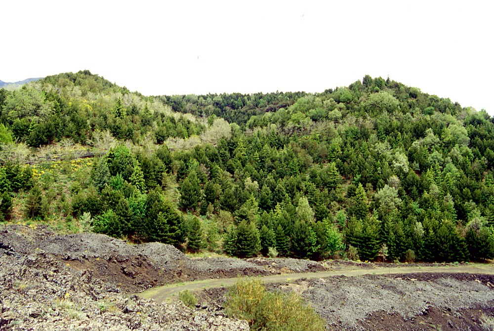 |
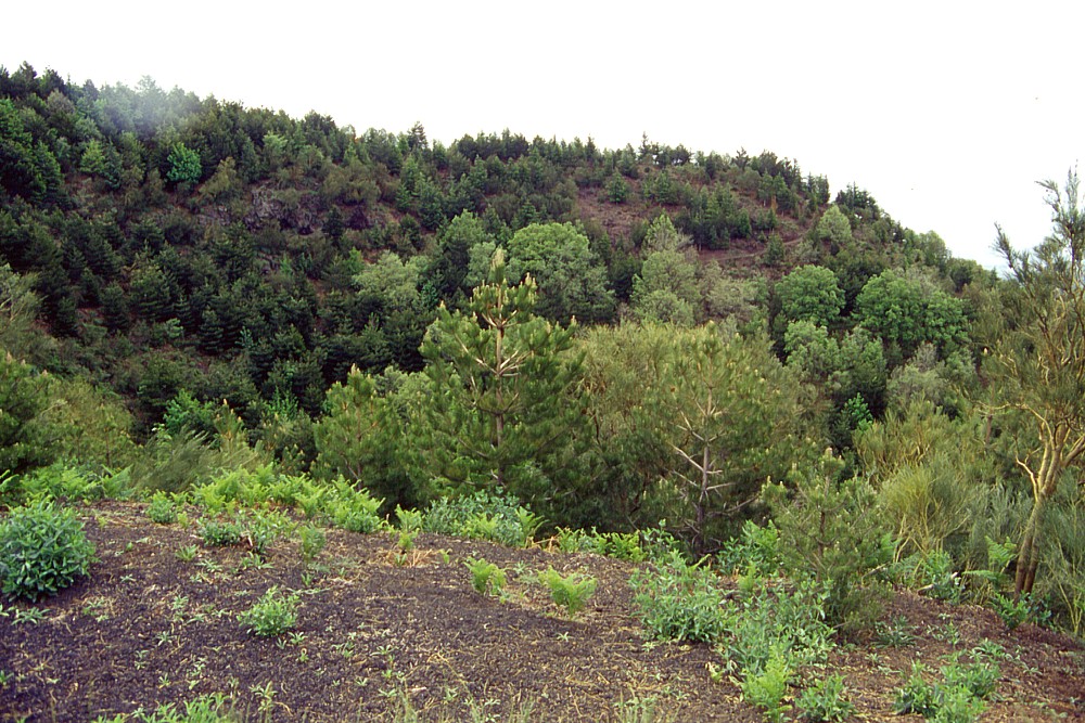
Surrounded
by numerous lava flows of the past three centuries, only the upper
portion of Monte Grosso ("the big mountain") is visible
today, but in the past it must have been a much more conspicuous
feature on Etna's middle south flank. Its densely forested cone
(the result of afforestation since the mid-20th century) is seen
here from the southwest base on 10 May 2000. A V-shaped notch
is visible in its southwest (near) crater rim, and lava of the
1892 eruption can be seen in the left foreground. During the 2001
eruption, Monte Grosso was once more encircled by lava flows,
which, however, did not reach the area shown in this photograph |
Mamma
Etna's countless children
Monte Grosso
S flank, 15.006707° E, 37.671457° N
Summit elevation: 1382 m
![]()
Following
the dramatic flank eruption of July-August 2001, one of the most scenic
areas on the south flank of Mount Etna was virtually cut off from access:
the area between Monte Gemmellaro (formed during the 1886 eruption) and
Monte Grosso, a prehistoric cone that once must have been a conspicous
landmark in the area and therefore was named "the big mountain".
The 2001 lava flow was but the latest of several lava flows that had reached
and buried the area in the 250 years since 1766, leaving Monte Grosso
like an ever smaller and lower island in the middle of terrible wastelands
of frozen rock, which the local people call "sciara". Before
the 1766 eruption, Monte Grosso was probably an enormous cone, truncated
by a broad (200 m diameter) summit crater with a deep notch in its southwest
side. Before the 2001 eruption, the height of the highest point on the
northern crater rim was little more than 10 m above the surface of the
surrounding 1892 lava field. On the opposite side, however, the height
of the cone was still some 130 m. The age of Monte Grosso is most probably
prehistoric; any associated lava flow lies buried under younger lavas.
Intense afforestation activity started in the mid-20th century has led
to the growth of a fine forest on the cone, transforming it into a green
island in a sea of dark lava. Fortunately, little of this forest was destroyed
by the lava of the 2001 eruption.
I visited Monte Grosso on 10 May 2000, about 14 months before the 2001
eruption which changed the nearby landscape considerably and temporarily
interrupted any access to the cone.
 |
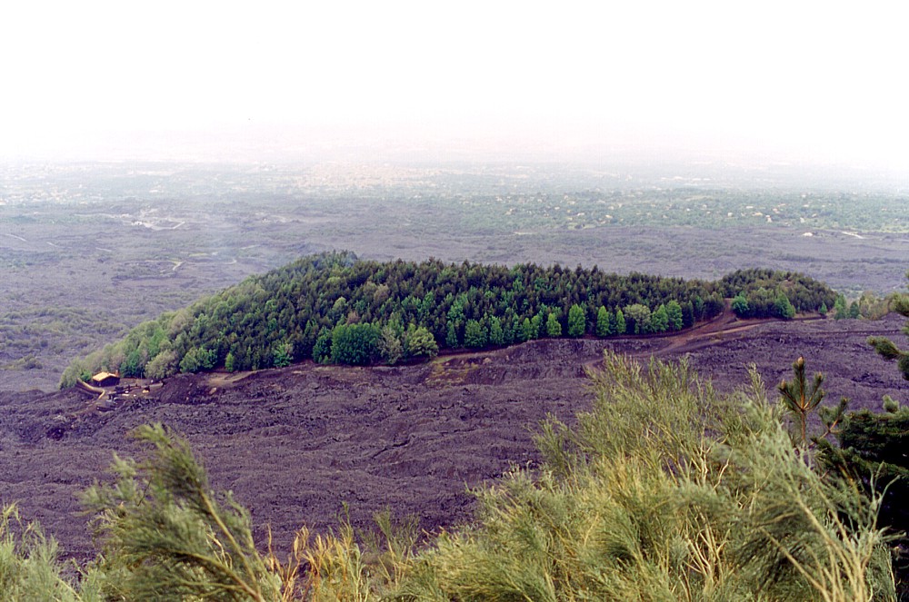 |
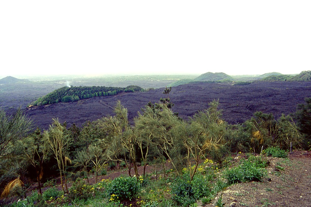
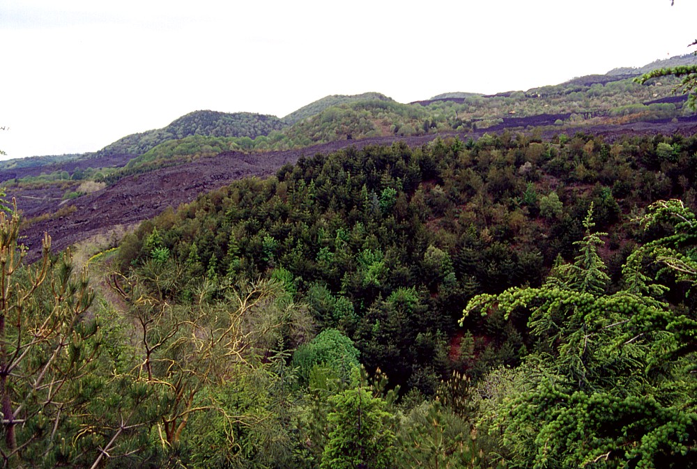
Monte
Grosso seen from Monte Gemmellaro (of the 1886 eruption), about
0.9 km to the NNE, on 10 May 2000. In these images it is seen
to be surrounded by lava of the 1892 eruption, but subsequently
(in July-August 2001) it was once more surrounded, on the near
side, by a lava flow. The three cones visible in the distance
in left photo are (from left to right) Monti
Rossi, Monte S. Leo, and Monte
Elici |
|
 |
 |
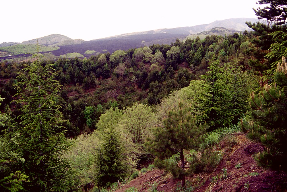 |
Crater
of Monte Grosso seen from different directions on 10 May 2000.
Left photo is a view from northwest, notch in southwest crater
rim can be seen at extreme right; center image shows the view
toward west from the eastern crater rim, with some of the other
pyroclastic cones of the area in the background (the largest is
Monte Manfrè and the second largest Monte Sona); right
image shows the northern half of the crater as viewed from the
southeast rim, and Monte Vetore is in the distance at left. Dark
lavas in the background in center and right photos is of the 1983
eruption |
||
Continue to Monte Sona
Copyright © Boris Behncke, "Italy's Volcanoes: The Cradle of Volcanology"
Page set up on 15 March 2004